
(click photo to enlarge)
Indians near Shell Rock Iowa, ca. 1848, From David Owen's Report of a Geological Survey of Wisconsin, Iowa, and Minnesota (1852)
Putting Native Americans Back on the Map:
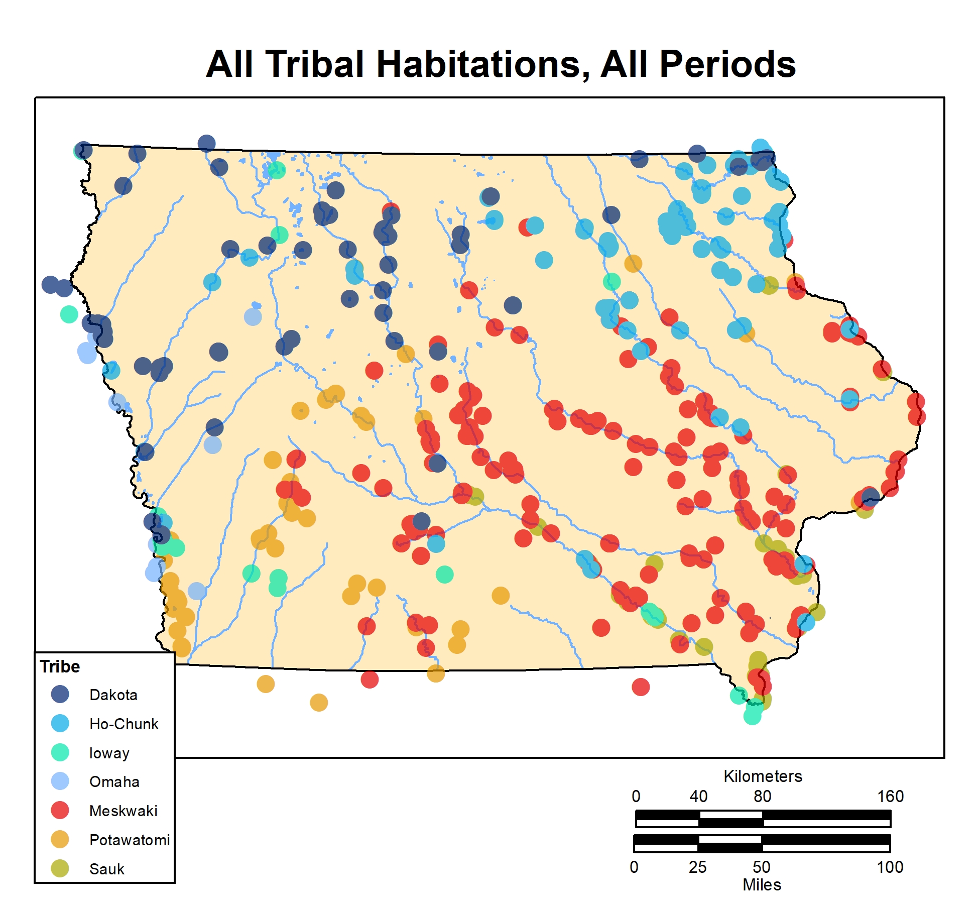
Iowa Historic Indian Location Database (HILD)
Native Americans are largely absent from historic maps of Iowa. Where did they live? Did they just disappear into the opaque fog of the blank part of the map? As Americans settled into lands held by natives in the 1800s, early maps may have noted treaty lines, trading posts, and forts, but generally not the location of established villages.
The Historic Indian Location Database (HILD) project uses overlooked historical sources to map American Indian sites in Iowa from the era of the earliest European explorers to the modern period. Its goal is to change Iowa's map from a blank landscape to one populated with villages, camps, and other locations, revealing map that is alive with events and encounters.
(click photo to enlarge)
(click photo to enlarge)
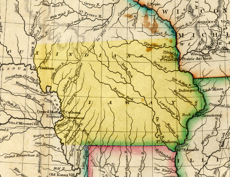
Stephen H. Long’s 1822 map of what would become Iowa, highlighted in yellow. The positons of American forts, mines, and trails are noted, but no Indian sites are shown, except for the "Yanktons" at Blood Run in northwest Iowa.
http:/goodearthbloodrun.com