(click photo to enlarge)
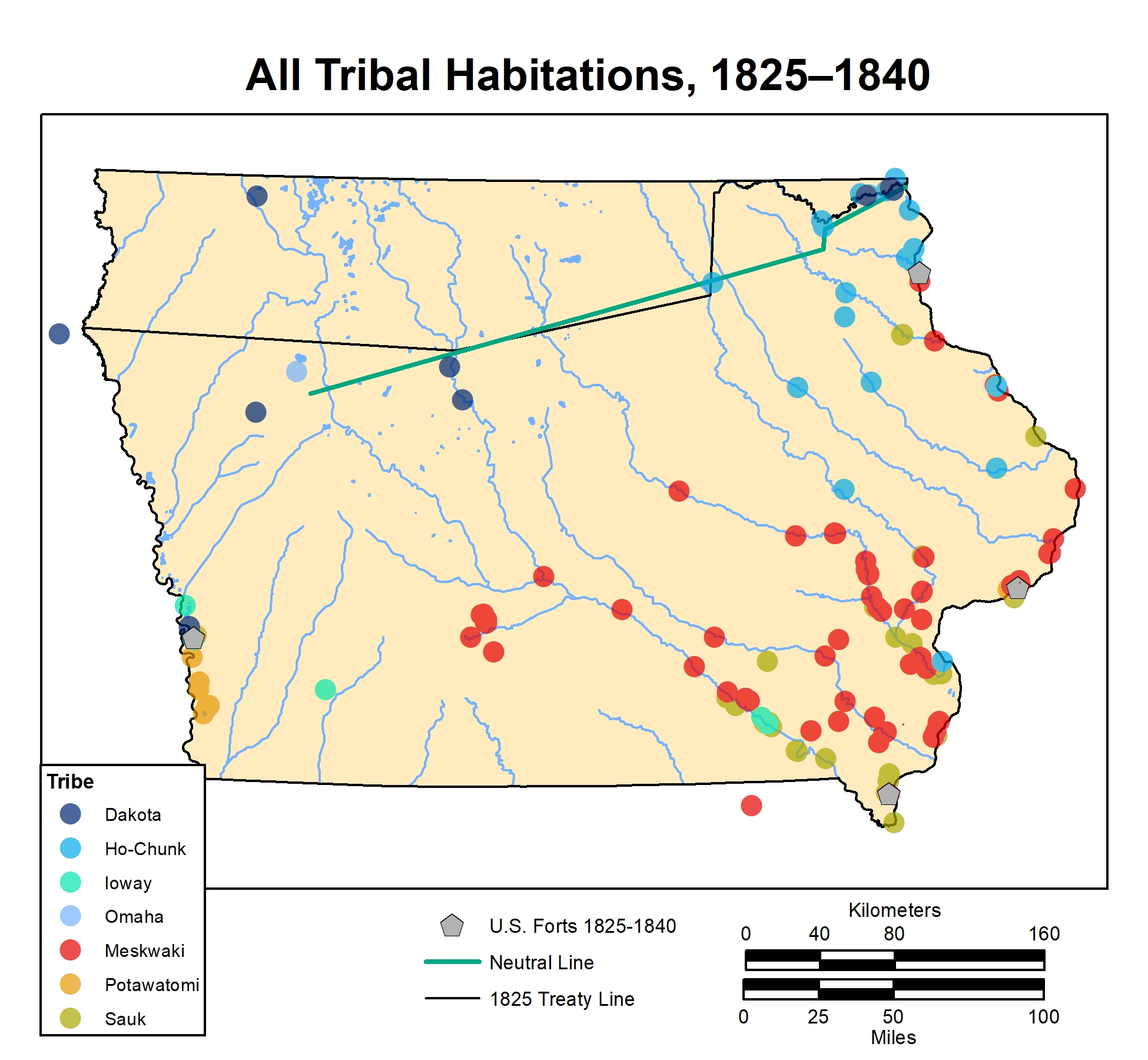
1825 – 1840
Beginning in 1825 the main treaty boundary in Iowa was the Neutral Line, which was intended to separate the Dakota to the north, from Sauk, Meskwaki, and Ioway to the south.
Originally the line was defined as beginning at the mouth of the Upper Iowa River, ascending the Upper Iowa to the headwaters of the left (south) branch, continuing on to the fork of the Cedar River, and ending at the upper fork of the Des Moines River; a proposed extension to the fork of the Big Sioux River was never agreed on.
The period when Dakota, Meskwaki, and Sauk were supposed to be abiding by the 1825 Neutral Line shows minor changes in the range of the three tribes. Although the 1825 treaty was not overtly designed to favor any tribe, the distribution of habitation sites and conflict sites suggests the Neutral Line ran through Dakota territory since Dakota continued to occupy sites along and both sides of the line. Wabasha maintained a village 2–3 miles from New Albin along the Upper Iowa, as noted in 1805 by Zebulon Pike. Dakota chief Tahama lived along the Upper Iowa River in 1819, 18 leagues above the Wisconsin River. Early surveyors later noted an abandoned Indian village in this general area.
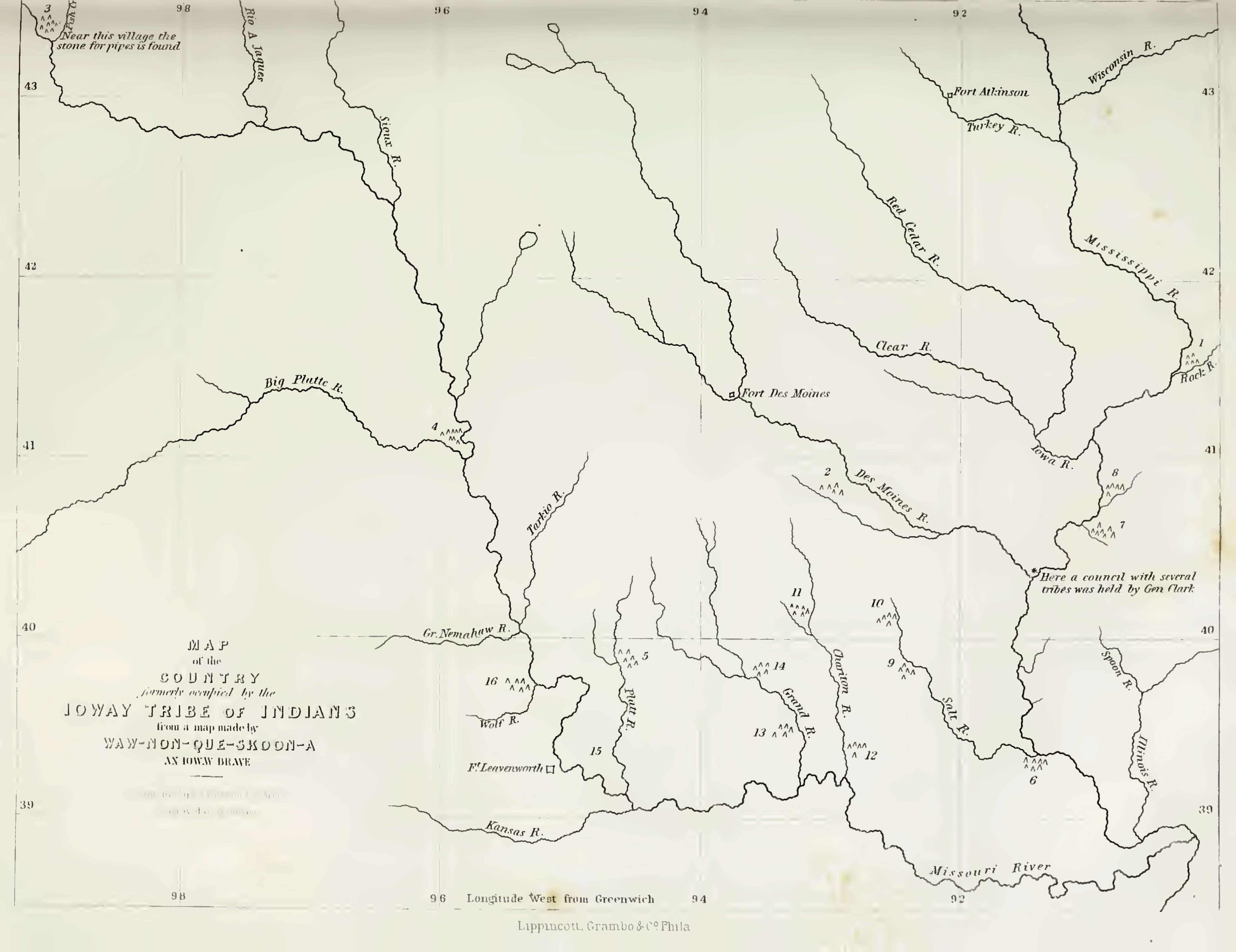
Although the Ioway were included in 19th-century treaties, they do not appear to have been living in Iowa after the 1830s. Historically, the Ioway had numerous villages in Iowa, many of which were mapped by No Heart in 1837, but these villages have proven impossible to locate with certainty. A later Ioway map shows the shift south towards Missouri.
(click photo to enlarge)
A map of Ioway locations was made in 1848 by “Waw-nonque-skoon-a, an Ioway Brave.” Showing early 19th-century village location.
The original has long been lost, but this modified copy of the map was published in 1852 by Henry Schoolcraft in the Archives of Aboriginal Knowledge.
In an 1832 treaty, the Neutral Line became the basis of the Neutral Ground, a strip of land on either side of the line, where Ho-Chunk would be forced to relocate from Wisconsin. In June 1832, Nathan Boone was charged with surveying this line; however, the line he surveyed did not follow the Neutral Line as defined in the 1825 or 1830 treaties but instead simplified the line with no explanation for the discrepancy.
In central Iowa, a series of treaties sought removal of Sauk and Meskwaki from Iowa after the Black Hawk Uprising of 1832. That year, treaties removed Sauk and Meskwaki away from the Mississippi Valley to the Iowa River basin, but they remained along the Mississippi through the early 1840s. The Meskwaki and Sauk were dispersed, but there were several recorded villages, including near Iowa City, Eddyville, and Ottumwa and near Fort Des Moines No. 1, now Montrose.

(click photo to enlarge)
Map Highlight: HILD 418: Quashquame’s village, late 1700s-1830s. A large Sauk village was here, from this location they could control trade on the Des Moines Rapids, a major obstacle on the Mississippi. The U.S. Army built Fort Des Moines No. 1 here in 1834.
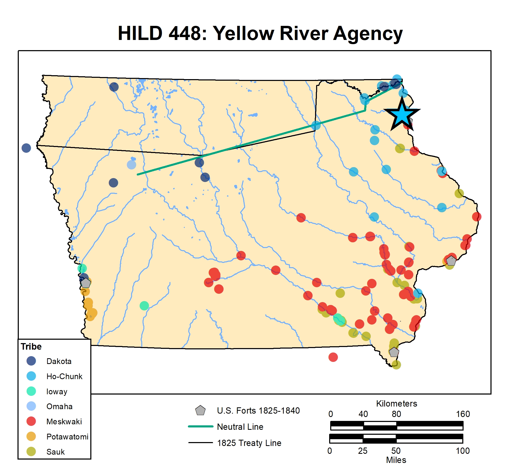
The period also witnessed the beginnings of forced relocation of Ho-Chunk into Iowa. Ho-Chunk were well familiar with the northeast quarter of Iowa before then, but in 1833, the government resettled several Ho-Chunk to the Yellow River, where an agency and mission were established. Soon, Ho-Chunk were seen throughout the state: for example, in 1839 a group of 300 Ho-Chunk reportedly camped near Cedar Rapids.
(click photo to enlarge)
Map Highlight: HILD 448: The Yellow River Agency and Mission, where Ho-Chunk were forcibly resettled, 1834–1840.
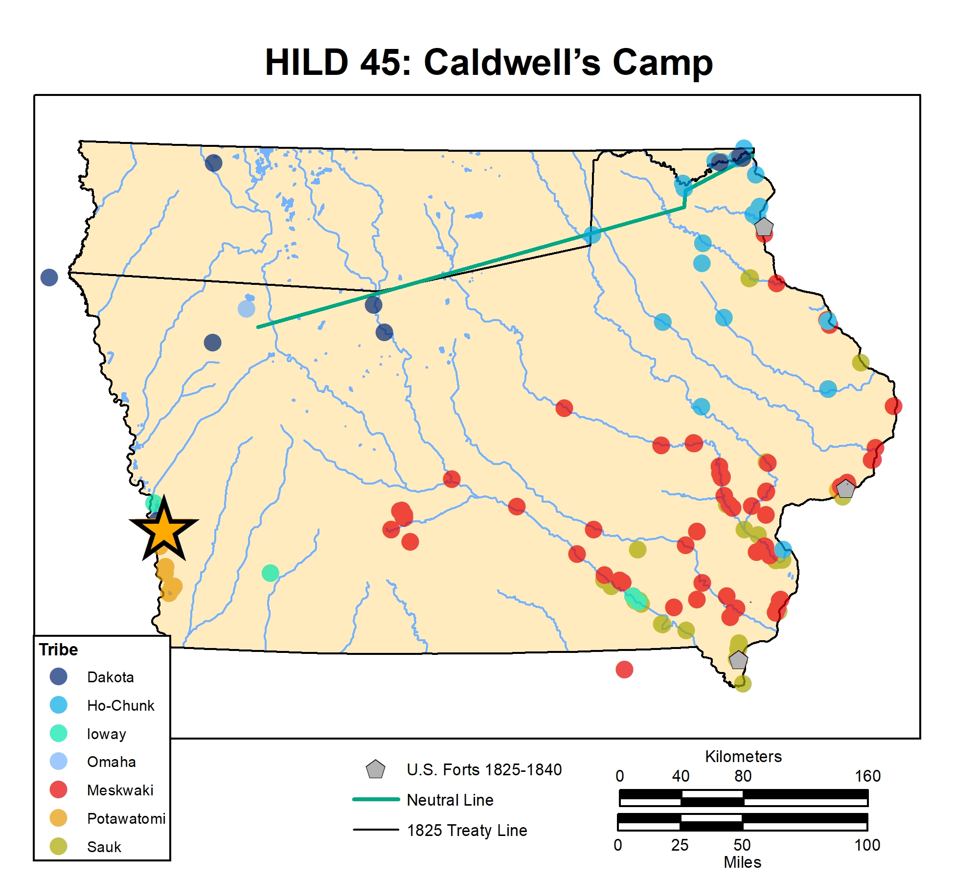
Potawatomi were moved to western Iowa in 1838, living in the Council Bluffs region; the most detailed accounts of their village locations come from missionary Pierre-Jean De Smet’s 1839 maps of the area. The Omaha occupied the Missouri River valley and interior areas during this period.
(click photo to enlarge)
Map Highlight: HILD 45: Caldwell’s Camp. This was the location of Billy Caldwell’s village. Caldwell was the leader of ca. 2,000 Potawatomi. His native name was Sauganash, and he was a comrade of Tecumseh during the War of 1812. Caldwell was well known when his band lived near Chicago in the early 1830s prior to the Potawatomi removal. His village in the bluffs above the Missouri Valley was taken over by Mormon travelers, renamed Kanesville, and later became the core of Council Bluffs, Iowa.
(click photo to enlarge)
Pierre Jean De Smet’s 1839 sketch map of what is now the Council Bluffs, Iowa area, showing Potawatomi villages.